Tanzania Maps and Orientation
(Tanzania, TZ, East Africa)
Located on the eastern side of
Africa and just below
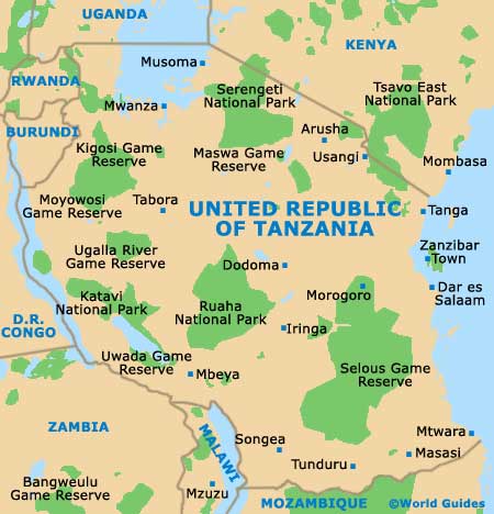
Kenya, the United Republic of Tanzania also borders a number of other well-known African countries, namely Burundi, the
Democratic Republic of the Congo,
Malawi,
Mozambique, Rwanda, Uganda and Zambia.
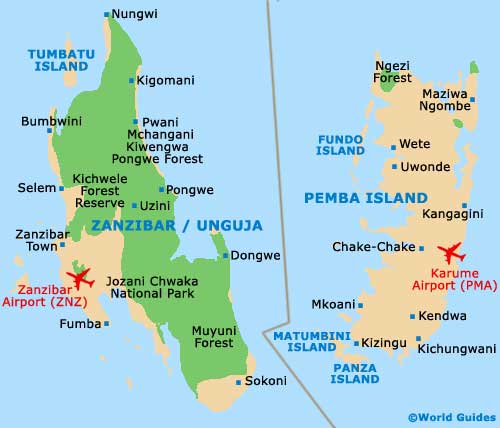
The Indian Ocean marks the eastern border of Tanzania and comes with a stunning coastline, where many popular beaches reside. Zanzibar, an autonomous region and archipelago, is also a part of Tanzania and is made up of two significant islands (Unguja and Pemba), as well as numerous smaller islands.
Maps and Orientation of the Country
Including Zanzibar, Tanzania comprises some six main regions (Central, North-East, North-West, Pembwe / South-East, the Southern Highlands and Zanzibar). In total, these are further subdivided into 26 different areas known as 'mikoa'.
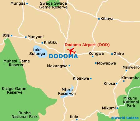
Dodoma now serves as the capital city, although former capital
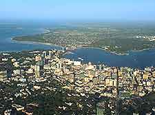
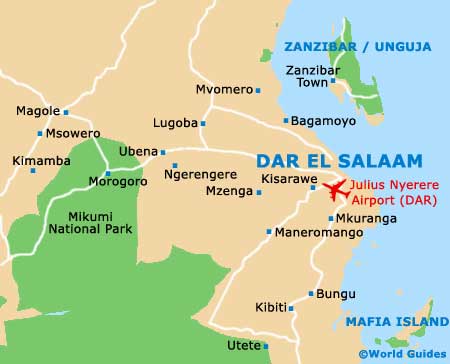
Dar es Salaam is a far bigger city and regarded as the political hub, as well as being a leading Tanzanian holiday destination and busy seaport.
- Burundi - north-west
- Democratic Republic of Congo - west
- Kenya - north
- Lake Malawi - south
- Lake Tanganyika - west
- Lake Victoria - north
- Malawi - south-west
- Mozambique - south
- Rwanda - north-west
- Uganda - north
- Zambia - south-west
Continent Map of Africa

Map of Tanzania
Map of Dodoma
Map of Dar es Salaam
Map of Zanzibar